The Tidal Schuylkill’s Historic Wharves

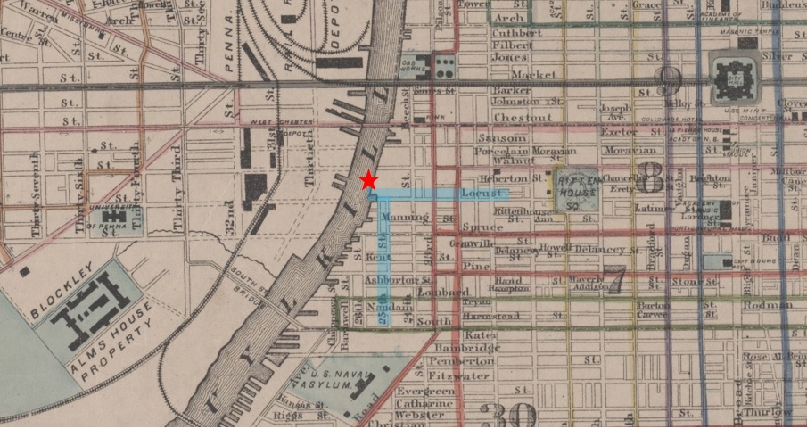
You are probably familiar with the grassy area along the tidal Schuylkill River near the Locust Street entrance to the trail. You may walk your dog there, fish off the bulkhead, participate in yoga or Parks on Tap, or maybe even watched a movie there (we used to have movie nights in that area). In the nineteenth century, that grassy lawn was actually within the river. The riverbank started near present-day 25th and Locust streets, as shown in the below map created by G.M. Hopkins in 1875 (Free Library Item No: MGMHAH00001). The red star on the map indicates the present-day grass lawn area, and Locust and 25th streets are highlighted in blue.
If you look closely at the above map, you will notice many of the streets projecting into the river – those are the nineteenth-century wharves and docks that were built to service the ships and barges transporting cargo to and from Philadelphia. According to a historic research study of this area completed by A.D. Marble & Company in 2009, “[t]he economy of the Schuylkill River and growth of the Schuylkill community was fueled by the transport of coal, lumber, and later ice and stone.” Coal and lumber came in from the north, and commodities went out to rural areas to the west and south of Philadelphia. By the end of the nineteenth century, 31 wharves lined the riverbank between Market and South streets, and the river was crowded with ships and barges.
The neighborhood adjacent to these wharves, known as the Schuylkill community, was largely a working-class community employed by the owners of the wharves and docks who lived in nearby Rittenhouse. This predominately Irish, working-class community not only labored to load and unload cargo, they also built the wharves and then eventually filled them in to make way for the Baltimore and Ohio Railroad in the late nineteenth century.
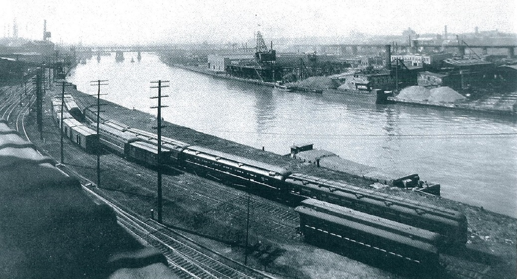 Above image taken in 1924 from Walnut Street looking south. Image source: Frederick, 1924.
The gradual switch from barges to railcars at the end of the nineteenth century is due to many factors such as the decline of the Schuylkill Navigation system, increased sedimentation in the upper Schuylkill River (making certain areas of the river impassable), and improved rail service. Once fully built, the railroad dominated the east bank of the Schuylkill River (as seen in the above photo) for a century before a group of neighbors came together with the City to build the Schuylkill River Park, and eventually to form SRDC and build Schuylkill Banks. The neighborhood surrounding the old wharves also changed dramatically during the twentieth century as bustling mills and factories were abandoned and then rehabilitated into the residential units we know today. Although the historic wharves of the tidal Schuylkill can no longer be seen, their impact on the growth of the surrounding community and Philadelphia is unmistakable.
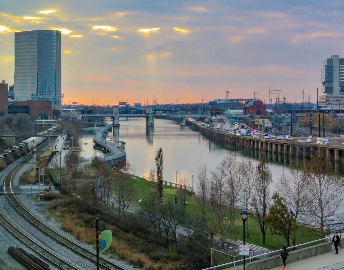 Above image taken in 2019 from Walnut Street looking south.


