Washington-Rochambeau Revolutionary Route

In 1781, General Jean Baptiste Donatien de Vimeur, comte de Rochambeau, led French Army officers and men from Newport, Rhode Island south to meet up with General George Washington’s Continental Army in Westchester County, New York. From there, 6,300 troops from both the French and Continental Armies marched south for Yorktown, Virginia and their eventual victory over the British Army, which signaled the end of the Revolutionary War.
The troops made many stops along this 600-mile journey, including camping along the Schuylkill River in Philadelphia as shown in the below map of the encampment. The pontoon bridge shown in the map is the approximate location of the Market Street Bridge. Get a brief history of this important river crossing here.
The route the French and Continental Armies marched is preserved as the Washington-Rochambeau Revolutionary Route and celebrates the allies’ joint efforts to achieve American independence. 2021 marks the 240th anniversary of this important march and eventual victory at Yorktown. Make sure to stop by the interpretive sign which stands just north of the Market Street Bridge to take in this historic route and encampment site. Learn more about the Washington-Rochambeau Revolutionary Route here.
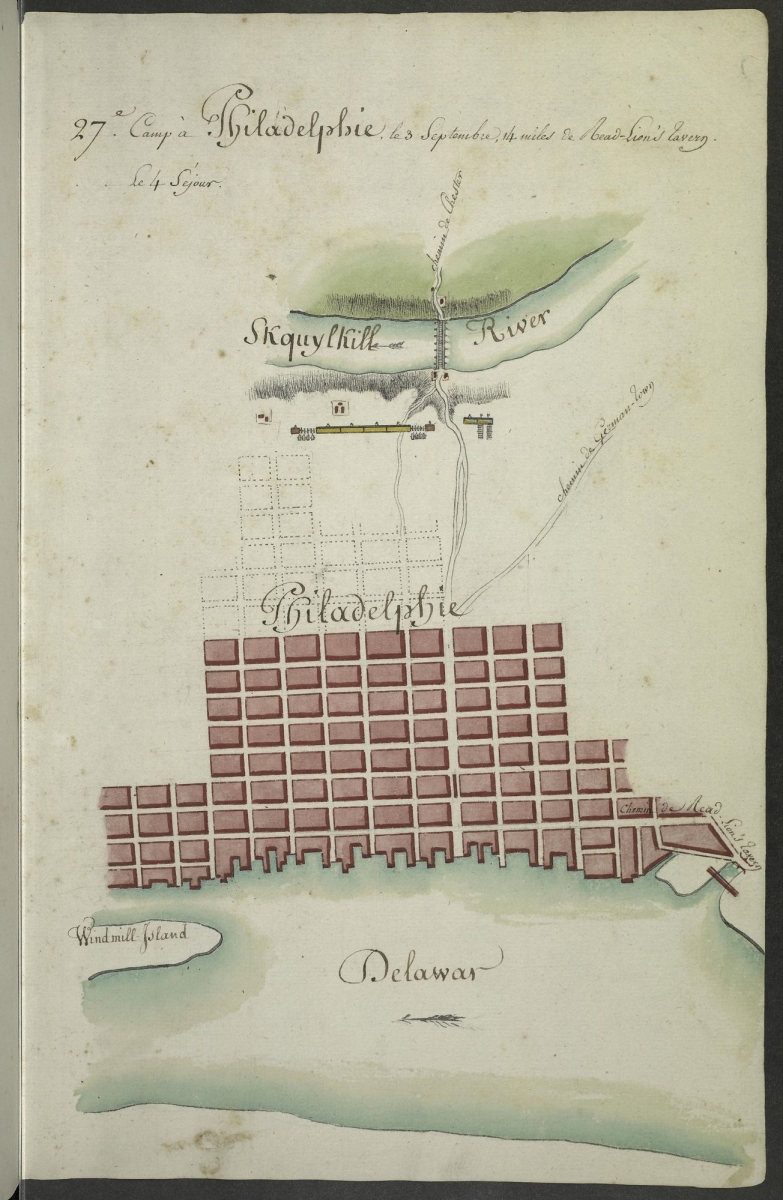 Image Credit:

